Railways in areas now comprising Pakistan started with the first track opening between Karachi and Kotri on May 13, 1861.
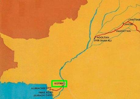
For the next 18 years, freight from Karachi port was shipped to Kotri and from their steamers of Indus Flotilla Company took it to Multan via river Indus and river chenab. On April 24, 1865 Multan was connected by Railways to rest of East India via Lahore and Amritsar.
Following is a map of Railways in Pakistan from the year 1870. One can see how the track stopped at Kotri and then commenced again from Multan to rest of East India via Pakpattan, Lahore, Present day Wagah border and Amritsar. This map is interesting because one should note the track starting from a small town near Multan called Sher Shah which is located on the banks of River Chenab. Also noticeable is that track in 1870 went through Pakpattan. This is not a mainline anymore as Mainline these days bypasses Pakpattan and reaches Lahore via Sahiwal and Raiwind.
Those familiar with Pakistan Railway’s network will realise how the current Mainline crosses Indus between Kotri and Hyderabad and then runs northward on East Bank of Indus via Nawabshah, Rohri and into Punjab province. This however was not always the case. Indus was not bridged at Gidu (between Kotri and Hyderabad) until 1900, therefore for atleast 22 years (1878-1900) the Main line of Pakistan Railways used to run on West Bank of River Indus. That is via Sehwan, Dadu, Larkana and Sukkur.
In a previous post we left the story of Pakistan Railways at Kotri. Today we will continue our journey on the West bank of Indus and see how the track progressed northward. This will be the similar route that we recently took via highway N55.
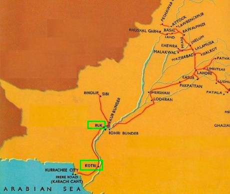
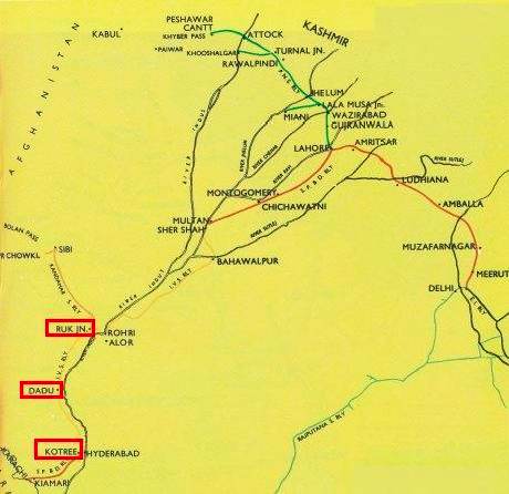
Following map shows the track on West Bank of Indus as it was in the year 1886. Note the location of stations called Kotri and Ruk shown in green rectangles. This is the railway section of our discussion today.
Kotri (Km 0):
Kotri is the starting point (0 km mark) on the railways that runs on West bank of River Indus and a very important junction on Pakistan Railway Network.
Following photo is courtesy of Mr. Andrew Jones. Shows Bolan Express at Kotri Junction before commencing on its journey on the track at West Bank of Indus.
After a train leaves Kotri on Indus West bank track, Railway stations appear in following order and distances.
Sindh University (8 km)
Cadet College Petaro (21 km)
Unarpur (33 km)
Budapur (41 km)
Khanot (50 km)
Gopang (56 km)
Manjhand (68 km)
Khuman (75 km) – now closed
Sann (86 km)
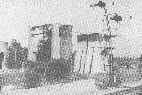
Sann station is famous for the presence of Persian Wheel well which was established here in 1878 and after a passage of 131 years, it is still operational. A camel is used to work the Persian Wheel. For the past 131 years, this well is the only source of water for Sann Railway Station. The photo below shows this well and the photo is circa 1961.
Amri (107 km):
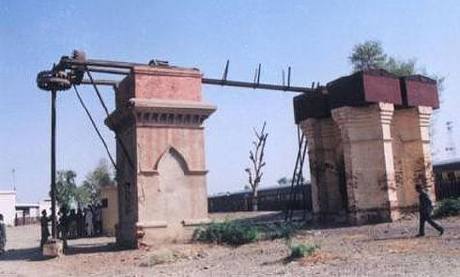
21 km north of Sann Station is Amri. While Amri is famous for the archaeological finds in the area which predate Moen-jo-Daro in Indus Valley Civilization, the Railway Station of Amri has a landmark similar to Sann Station i.e. a working Persian Wheel well from the year 1878.
The photo below is courtesy of Iqbal Samad Khan and is circa 2003.
Lakhi Shah Saddar (122 km):
Lakhi Shah Saddar was the end point of the seconf section of Railway track which was opened on West Bank of Indus. The 122 km section between Kotri and Lakhi Shah Saddar was opened on October 8, 1878. Why Lakhi Shah Saddar was chosen as an end point of the secion? Most likely because it is the last station after which rail track goes into Kirthar Range and experiences steep grades. We’ll read more about it below.
Bago Toro Pass
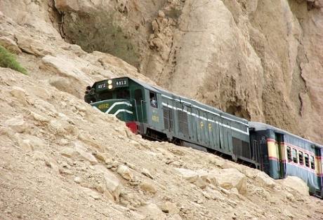
After Lakhi Shah Saddar station and before Sehwan, the railway track goes through a very interesting landscape. It is called the Bago Toro Pass in Kirthars. The gradient on this section is 1 in 50. This means that the track rises or falls one foot vertically in every 50 feet traversed horizontally. As a result trailing loads of locomotives are restricted to 800 tonnes gross. Cosequently the looping capacity at stations is also restricted to 1500 feet while on the Main Line it is 2500 feet. Railways has been planning to ease out the grades on this section by skirting the Indus river. This could not be done earlier because of the close proximity of the river to the track. The Indus over the years has moved away from the tracks. Once the grade is eased out this section could also take loads of 2250 tons and can become a good alternate for freight traffic moving from Sindh province to NWFP and Southern Punjab.
Bagatora (132 km) Railway Station- now closed
This station was located at approximately half way in the Bago Toro pass and provided trains a crossing and resting place in the heavy-work pass. This station is now closed.
Sehwan Sharif (140 km):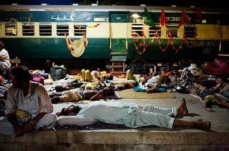
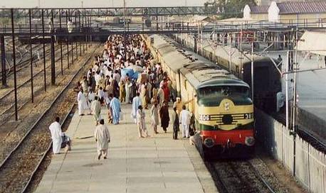
The photo above shows crowded platform of Sehwan Station during the urs of Lal Shahbaz Qalandar.
Note how a train compartment in the background has been decorated with colorful flags as part of the annual urs at Sehwan.
After Sehwan, the railway stations come in following order and distances.
Bubak Road (152 km)
Bhan Sayadabad (162 km)
Khudabad (171 km)
Dadu (181 km)
Phulji (196 km)
Piaro Goth (206 km)
Rehmani Nagar (217 km) – previously called Sita Road
Balishah (227 km)
Shah Panjo (Halt) (231 km)
Radhan (235 km)
Sihar (244 km)
Badah (254 km)
Moen-jo-Daro (261 km) – previously called Dokri
Bakhsh Jatoi (Halt) (265 km)
Haider Jatoi (Halt) (269 km)
Bakrani Road (272 km)
Mashori Sharif (Halt) (276 km)
Larkana Jn (284 km)
Larkana, as many of our reader may know is the largest city in Western Sindh and a Railway junction too. A track from Larkana branches off towards west and reached Jacobabad Junction via Silra Shahdadkot. This branch track follows the protective embankment (bund) of Sindh Right Bank.
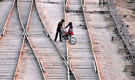
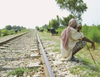 The photo to the right shows a portion of track near Larkana junction and a person taking rest while his cattle grazes nearby.
Originally the Larkana – Silra Shahdadkot – Budapur was a NG (narrow gauge) railway portion. From Larkana to Silra Shahdadkot section was converted to BG (Broad Gauge) to join Jacobabad on the other end to complete the Sindh Right Bank Feeder Railway, which now measures 136 km (83.98 miles). The NG section from Silra Shadadkot to Budapur was dismantled.
Following is a photo of Larkana junction Railway Yard taken on Sept 26, 2009.
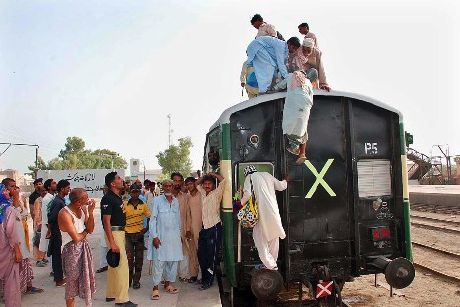
The annual urs of Lal Shahbaz Qalandar in August of every year is the busiest time for railway on this section. Following photo shows an overcrowded train leaving Larkana Jn for Sehwan in august 2009.
Mahiota (294 km):
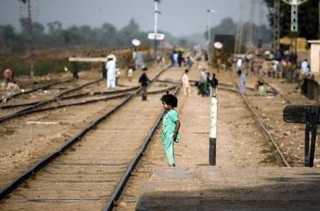
The photo below is a shot from Mahiota Station’s platform. Photo credits belong to Agha Waseem Ahmed.
North of Mahiota, railway stations come in following order and distances.
Shah Nawaz Bhutto (304 km)
Nasrat (Halt) (310 km)
Madeji Road (318 km)
Allahdadani (329 km)
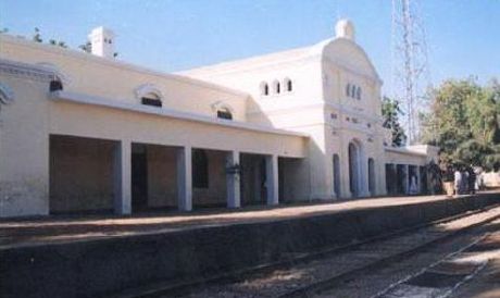
Ruk (339 km) – The Historic Junction
Ruk is the historic station which used to be a junction when British first laid the railway line here. It connected Rohri-Quetta line with the track coming from Kotri. In a later alignment, Habib Kot was made the junction where as Ruk got straight through track between Habib Kot and Larkana.
I will also bring to our reader’s attention the second map from top in this post which shows how Ruk used to be the junction on Rohri-Ruk-Sibi and Run-Kotri Railway line.
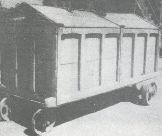 The photo to the left is circia 1961. It shows a very historic trolley which was in use by Pakistan Post at Ruk in the 60s. The construction of this van is very similar to ‘Treasury Vans’ once used on the I.V.S Railway during the 19th century.
Following map shows the railway track in present day Pakistan and in North India in 1883. I will bring to our reader’s attention the very light yellow track shown from Kotree – Dadu – Ruk – Rohri – Bahawalpur – Sher Shah and Multan which was part of the historic I.V.S railways.
Habib Kot Junction (347 km)
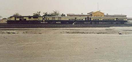
Following photo is courtest of Mr. Andrew Jones and shows a train idling at Habib Kot junction. Habib Kot is the present day juction of Railway line coming from Kotri via Larkana and the Main line between Sukkur and Quetta. Habib Kot became a junction after realignment of track at Ruk.
The track from Kotri to Sukkur was completed in 1878. However Indus had not been bridged yet either at Rohri or Kotri.
Therefore from 1879 onwards trains used to haul freight and passenger traffic all the way from Karachi port to Sukkur without crossing Indus entirely on its West Bank.
From Sukkur a rail ferry service transported train coaches across the river waters and onto east bank. This Railway Ferry Service contniued for atleast 10 years until the famous Lansdowne Bridge was opened for Rail traffic on March 19, 1889.
In 1900 when Indus was finally bridge at Gidu (between Kotri and Hyderabad), the Main Line and all major rail traffic got diverted to East Bank of River Indus where as the West Bank track got reduced to rail traffic between Karachi and Quetta.
Chronology of Kotri – Habibkot Section
May 13, 1861: First Railways of Pakistan inaugurated between Karachi City and Kotri.
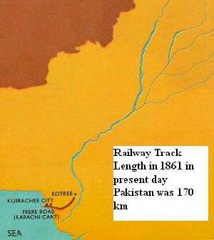 The map to the right shows the begining of Railway Tracks in the areas that now form Pakistan. As evident from this map in 1861, there was 170 km (104 mi) of track operational between Karachi and Kotri. Note the emptiness on this map compared to small portion of railway track in 1861.
October 1, 1878: Radhan to Ruk section opened for Rail Traffic (64.14 miles)
October 8, 1878: Kotri to Lakhi Shah Saddar section opened (75.52 miles)
October 27, 1878: Lakhi Shah Saddar to Radhan section opened (70.48 miles)
March 19, 1889: Lansdowne Bridge inaugurated, which provided a rail crossing over Indus between Sukkur and Rohri.
May 25, 1900: Railway Bridge over Indus inaugurated at Gidu between Kotri and Hyderabad.
July 29, 1940: Larkana to Jacobabad section opened in Broad gauge.
1942: Heavy floods in this year did extensive damage to railway tracks on West bank of Indus.
April 16, 1946: Realignment of track was done between Habib Kot jn and Ruk (4.95 miles)
post by: http://Pakistaniat.com


