Stefan Geens on his blog revealed that by using Google Earth he has figured out the exact location of Baitullah Mehsud’s in laws house where he was present at the time of US drone attack and was killed.
Stefan says that he figured out the exact location of a village in remote areas of Wazirastan, Federally administered Tribal Areas, by cross referring to different news articles published in media.
After the incident, BBC reported:
The missile fired by the US drone hit the home of the Taliban chief’s father-in-law, Malik Ikramuddin, in the Zangarha area, 15km (9 miles) north-east of Ladha, at around 0100 on Wednesday (1900 GMT Tuesday).
Stefan writes on his blog:
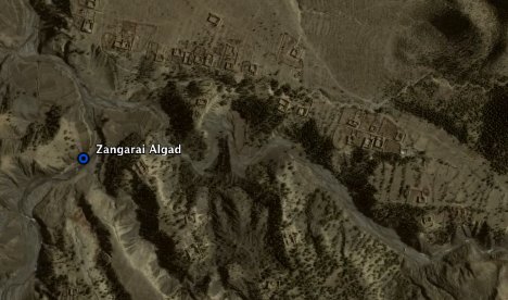
Ladha was easily found via a default search in Google Earth (and the returned placemark comes courtesy of an entry in Google Earth Community); it is indeed in the South Waziristan region of Pakistan, and is the location of an old British fort. Then it was a matter of finding Zanghara. Here Geonames.org once again proved to be an invaluable resource. A fuzzy search for “Zangarha” in Pakistan returned one clear answer exactly 15km northeast of Ladha: Zangarai Algad, where “algad” denotes that the feature name is a stream or shallow valley. This valley extends northeast-southwest for a few kilometers, and I think it is likely this is the place referred to by the article.
Stefan first found out Zangarai Algad, below image:

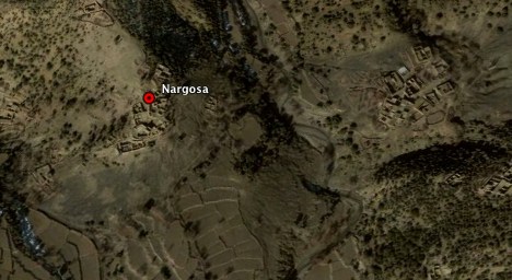
Stefan finally connecting the dots located the exact location of that house in the village of Nargosa. Below image:

If you want to view this map in Google Earth, then download this POI and open it with Google Earth.
src=’teenspk.com’


November 28th, 2009 at 11:09 PM
Nice Post. But still this article lacks clear cut and authentic indormation. Authentic sources along with web links, if provided will make this article more informative and reliable. More details should be added